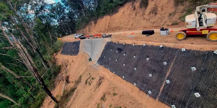
The application of Eurocode 7 Design Approach 1 within the City of Sunderland requires a nuanced interpretation of the local geological succession. The incised valleys of the River Wear, cutting through the Magnesian Limestone Plateau, create steep natural and engineered slopes where the interface between the limestone and the underlying glacial till frequently governs stability. Our team approaches each analysis in Sunderland by first reconciling BS 5930:2015 site investigation data with the specific geomorphological features of the Durham coast, where abandoned mining bell pits and coastal erosion add complexity to the ground model. This is not a generic desk study; it demands targeted rotary drilling to confirm rockhead geometry and detailed laboratory testing of the weathered till matrix to define effective stress parameters for the c' and φ' values used in limit equilibrium calculations.
In Sunderland's River Wear gorge, slope stability is governed less by intact rock strength and more by the joint-controlled failure of the limestone caprock combined with the pore pressure response of the underlying till.
Regional considerations
A recurrent issue encountered in Sunderland's slope stability analysis is the assumption that the fill materials identified in historical maps of the port area are homogeneous or equivalent to the natural till. In practice, many slopes along the Wear's lower reaches contain undocumented colliery spoil, ballast, and industrial waste that exhibit metastable structure; when saturated, these materials can undergo rapid collapse compression, triggering retrogressive failures that propagate upslope. An assessment that relies solely on a single borehole and neglects the spatial variability of these fill types will systematically underestimate the Factor of Safety. The consequences in Sunderland, where terraced housing and Victorian infrastructure often sit directly above such slopes, demand that the ground investigation be spatially solid and that the analysis explicitly models the weak basal layer of spoil, checking not just for global stability but also for internal erosion and piping risks.
Quick answers
What geological factors most influence slope stability in Sunderland?
The primary control is the interface between the Permian Magnesian Limestone and the underlying glacial till. This contact, visible along the River Wear gorge, creates a permeability contrast where groundwater accumulates, reducing effective stress in the till. Additionally, the presence of abandoned mine workings and historical fill in areas such as the East End introduces zones of high compressibility and variable strength that must be mapped explicitly in the ground model.
What is the typical cost range for a slope stability assessment in Sunderland?
For a site-specific analysis including a ground investigation, laboratory testing, and limit equilibrium modelling, the cost generally ranges from £1.090 to £3.080. The final figure depends on the slope height, the complexity of the ground conditions, the number of piezometers required for groundwater monitoring, and whether a back-analysis of an existing failure is needed.
How does BS EN 1997 apply to slope stability analysis in the UK?
BS EN 1997 requires that slope stability be verified for both short-term (undrained) and long-term (drained) conditions using Design Approach 1. This means applying partial factors to actions and material properties across two combinations. In Sunderland's till, the drained condition with factored effective stress parameters and residual strength values often proves critical, particularly where the slope has a history of movement.