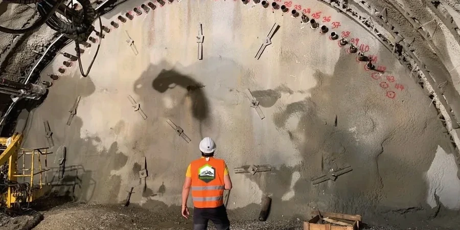
Sunderland’s post-industrial landscape, shaped by centuries of coal mining and limestone quarrying, presents a geotechnical puzzle that makes excavation monitoring more than a contractual checkbox. Much of the city sits on glacial till overlying the Magnesian Limestone, but pockets of made ground and undocumented mine workings—particularly in the Hendon and Deptford wards—can turn a routine 4-metre cut into a settlement trigger. When the University of Sunderland expanded its Sir Tom Cowie Campus, monitoring arrays recorded lateral movements of less than 2 mm at the diaphragm wall, a result that only held because we established solid baseline readings before the first bucket entered the ground. For any excavation deeper than 3 metres in the city, we integrate automated inclinometer strings and vibration monitors that feed into a cloud-based dashboard, allowing the structural engineer to compare real-time data against slope stability design assumptions and adjust the temporary works sequence if the convergence rate exceeds 0.5 mm per hour—a threshold we calibrate based on the condition survey of adjacent Victorian terraces.
In Sunderland’s mixed ground, a well-designed monitoring plan is the difference between a controlled excavation and a costly party wall claim.
Regional considerations
The equipment we deploy on Sunderland sites is deliberately redundant: a single inclinometer casing might house both a manual probe and a fixed MEMS string, because if the automated system loses power during a night shift and the wall continues to deflect, the manual backup reading taken the next morning could be the only record that prevents an unsafe condition from going unnoticed. Each settlement stud is installed into a steel pin driven to refusal in the bearing stratum, not simply glued to the pavement, to eliminate the risk of the monitoring point itself moving independently of the ground. Our technicians calibrate the total station network against a deep benchmark installed at least 15 metres beyond the predicted settlement trough, a precaution that proved essential during a deep excavation on Toward Road where surface benchmarks outside the site compound had settled by 1.2 mm due to a leaking water main—an error that would have masked real excavation-induced movement if the deep benchmark had not been in place.
Standards that apply
BS 5930:2015+A1:2020 — Code of practice for ground investigations, BS EN 1997-1:2004 (Eurocode 7) — Geotechnical design, including monitoring requirements for Observational Method, CIRIA C760 — Guidance on embedded retaining wall design, including monitoring clauses for UK practice, BS 7385-2:1993 — Evaluation and measurement for vibration in buildings
Quick answers
What is the typical cost range for excavation monitoring on a single-basement project in Sunderland?
For a residential basement excavation of approximately 100 to 250 square metres in plan area within the Sunderland area, the monitoring scope typically falls between £640 and £1,900 depending on the number of monitoring points, whether automated inclinometers are required versus manual survey, and the duration of the monitoring period. This includes the pre-condition survey, installation of settlement studs and crack gauges on adjacent properties, and weekly reporting for the duration of the cut. Projects requiring piezometer arrays or vibration monitoring near listed structures will sit at the upper end of the range.
How does BS 5930 influence the monitoring plan for an excavation in Sunderland?
BS 5930:2015+A1:2020 provides the framework for designing a site-specific monitoring scheme based on the ground model. For Sunderland, where the sequence typically includes made ground over glacial till and Magnesian Limestone, the code guides the selection of instrumentation types, the frequency of readings, and the establishment of trigger levels that reflect the actual stiffness and drainage characteristics of each stratum. It also mandates that the monitoring plan be reviewed whenever the ground conditions encountered during excavation differ materially from the desk study and ground investigation, which happens more often than many contractors expect in areas of historical mining.
Can you monitor an excavation adjacent to a building with a party wall agreement in place?
Yes, and in many cases the party wall surveyor will specifically request a monitoring regime as a condition of the award. We set up precise levelling points on the party wall itself, along with tell-tale crack gauges across any existing defects, and provide a schedule of condition that is jointly signed before works commence. If the measured movement approaches the agreed trigger level—often set at 5 mm of differential settlement for masonry structures in the Sunderland area—the site team is alerted immediately so that the temporary works can be reviewed before damage occurs. This documented chain of evidence is invaluable if a dispute arises later.